
by ANDREW PAUL

Four at-risk, hard-to-reach historical sites in Afghanistan are being painstakingly recreated for virtual preservation.
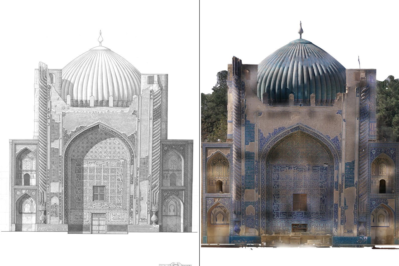
A documentary project using cutting edge 3D imaging, drone photography, and virtual reality combined with painstakingly detailed hand drawings is digitally preserving some of Afghanistan’s most awe-inspiring, endangered historical sites. On Friday, MIT previewed the impending release of “Ways of Seeing,” a collaborative effort between MIT Libraries and its Aga Khan Documentation Center alongside the Aga Khan Trust for Culture that aims to create “extended reality” (XR) experiences of significant architectural locales throughout the country.
“Ways of Seeing” currently focuses on four separate historical sites across Afghanistan: the Green Mosque in Balkh, a Buddhist dome south of Kabul known as the Parwan Stupa, the 15th century tomb of Queen Gawhar Saad, and the 200-foot-tall Minaret of Jam, built during the 12th century in a remote location in western Afghanistan. According to MIT’s announcement, scholars chose the sites for their architectural and religious diversity, as well as the relative inaccessibility of some of the locales.
To amass the visual data, MIT researchers worked alongside an Afghan digital production crew that traveled to the chosen sites after being remotely trained to pilot a “3D scanning aerial operation.” Once there, the on-location journalists collected between 15,000 and 30,000 images at each location. Meanwhile, Nikolaos Vlavianos, a PhD candidate in MIT’s Department of Architecture Design and Computation group, led an effort to “computationally [generate] point clouds and mesh geometry with detailed texture mapping.”
Afterwards, Jelena Pejkovic, an MIT alum and practicing architect, created detailed drawings of the locations via VERNADOC, a traditional ink rendering technique first developed by the Finnish architect Markku Mattila. “I wanted to rediscover the most traditional possible kind of documentation—measuring directly by hand, and drawing by hand,” Pejkovic said in Friday’s announcement.
Popular Science for more
(Thanks to reader)